Walking the MST into Elkin | Photo © Joe Mickey
Segment 6: The Elkin Valley
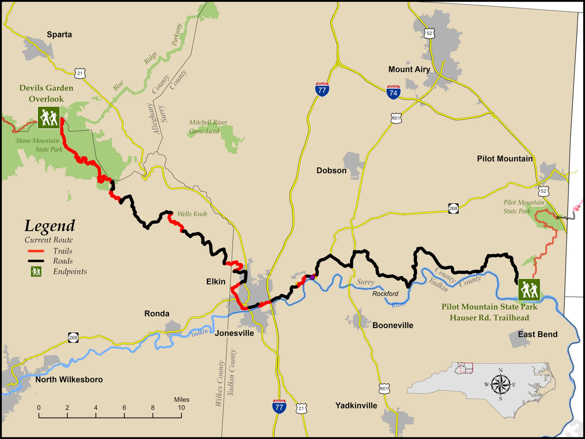
Devils Garden Overlook to Pilot Mountain State Park
Distance: 69.6 miles (24.1 miles on trail, 5.5 miles on gravel road, 40.0 miles road walking)
Difficulty:
 to
to
Easy to moderate except on the western side of Stone Mountain State Park, which is very strenuousTrail Communities: Elkin, Rockford
Check Trail Updates before starting your hike. To receive email notifications of new trail updates, click here and subscribe to “Trail Updates.”
If you find hazardous conditions or maintenance needs along the trail, please notify us using the form at mountainstoseatrail.org/the-trail/trail-issues.
By Bob Hillyer and Friends of the Mountains-to-Sea Trail
This 69-mile segment marks the transition from mountains to Piedmont as the trail drops more than 2,000 feet in six miles off the Blue Ridge Parkway (BRP) to a tranquil valley within Stone Mountain State Park. At the base of the massive granite monolith that gives the park its name, hikers enter a gentler landscape at the Hutchinson Historic Homestead.
Highlights Include
- Stone Mountain State Park with its massive granite monolith, numerous waterfalls, designated trout streams, horse trails, and technical climbing on a 600-foot rock face
- Wells Knob, offering views of the mountains and the Piedmont from its 1,600-foot peak
- Easy hiking along the Elkin & Alleghany “rails-to-trails” as you enter Elkin
- A stroll down Main Street Elkin, where the sidewalks are marked to tell you that you’re on the MST
- A possible side trip to hike portions of the Revolutionary War–era Overmountain Victory Trail
- An alternate paddle to complete the eastern part of this segment from Elkin to Pilot Mountain State Park
- Historic Rockford, founded in 1790, which provides a pleasant stop halfway between Elkin and Pilot Mountain
- Pilot Mountain, which rises abruptly from the rolling hills, resembling the mesas out West
Elevation
Segment 6 Eastbound Elevation Profile

Photos