Bridge Over Boone Fork | Photo © Adam Collins
Segment 5: The High Country
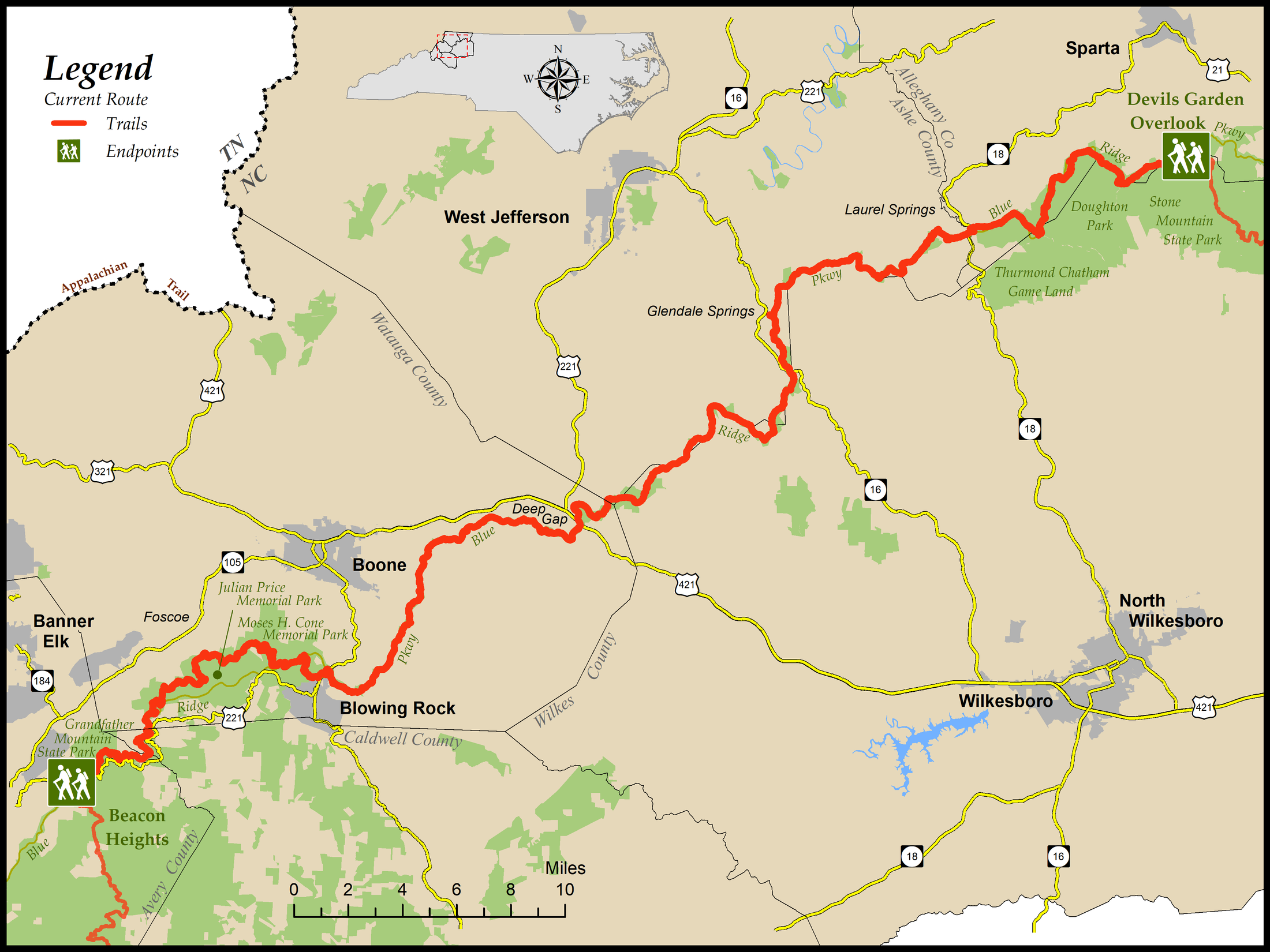
Beacon Heights to Devils Garden Overlook
Distance: 84.9 miles (11.6 on road or BRP shoulder; 73.3 miles on trail)
- Difficulty:
 to
to 
Easy to moderate with only a few strenuous parts Trail Community: Blowing Rock
Check Trail Updates before starting your hike. To receive email notifications of new trail updates, click here and subscribe to “Trail Updates.”
If you find hazardous conditions or maintenance needs along the trail, please notify us using the form at mountainstoseatrail.org/the-trail/trail-issues.
Special Note
Beginning May 1, 2023, the Blue Ridge Parkway is undertaking a three-year repaving and rehabilitation project along the main road between Mileposts 229.6 and 305.1, encompassing virtually all of MST Segment 5. The project is expected to continue until at least September 2025.
During the project, full or partial closures will be implemented on a staggered basis, allowing for continuous access to all recreational areas and visitor amenities including the MST. The MST will remain open; however, access to some trailheads will be restricted, and long detours between access points may be required. In addition, some locations where the trail crosses or goes along the shoulder of the Parkway may be temporarily closed during active work.
These access limitations will, in turn, affect the ability of volunteer crews to perform trail maintenance. Although we will do our best to keep the trail in a passable condition, we may not be able to maintain our usual high standards.
More information about the project, including a map (not necessarily completely current) of closed or partially closed road sections, is available at www.nps.gov/blri/learn/news/blue-ridge-parkway-begins-major-road-project-in-northwest-north-carolina.htm. The most up-to-date closure information is at www.nps.gov/blri/planyourvisit/roadclosures.htm and in visitor centers along the route.
By Carolyn Sakowski and Friends of the Mountains-to-Sea Trail
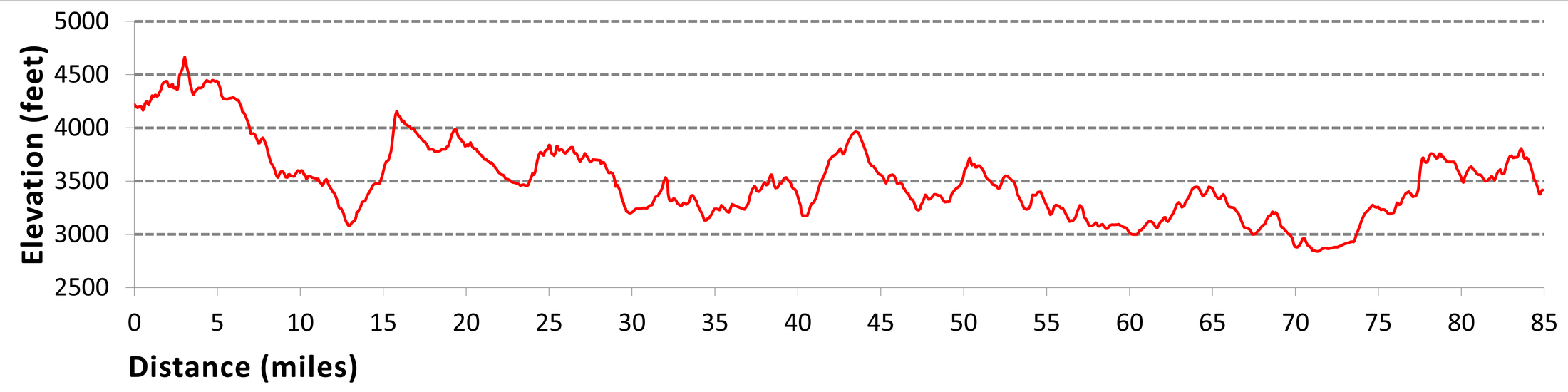
This segment, covering almost 85 miles, offers the hiker some of the most astounding scenery in northwestern North Carolina. This part of the trail, which travels along the ridgeline where elevations range from 4,300 to 3,400 feet, offers views looking down the escarpment into the North Carolina Piedmont.
Most of this section runs parallel to the Blue Ridge Parkway (BRP) and often crosses the parkway as the trail goes back into the woods and away from the road. There are a few stretches that cross fields, which will sometimes share space with friendly cows. There are also a few patches where the trail travels along a backroad or the shoulder of the BRP, but most of this segment is on well-engineered footpaths that make the ascents and descents easy to hike. Although the BRP is always nearby, you often feel that you are deep in the woods, miles from civilization.
This section begins at Beacon Heights and follows the Tanawha Trail as it travels along the base of Grandfather Mountain, one of only 553 certified biosphere reserves in the world. It continues past the resort town of Blowing Rock, travels near West Jefferson, and ends near Sparta in the northwest corner of North Carolina near the Virginia border.
Highlights Include
- The Linn Cove Viaduct, a 1,243-foot concrete engineering marvel that carries the BRP around the base of Grandfather Mountain
- Views of Grandfather Mountain, Table Rock, Hawksbill, and Pisgah National Forest that can encompass over 50 miles on a clear day
- Moses H. Cone Memorial Park, where the MST uses the park’s former carriage trails and passes by Flat Top Manor, which now serves as the parkway’s craft center
- E.B. Jeffress Park with the restored cabin of farmer Jesse Brown and Cool Springs Baptist Church as well as “The Cascades” waterfall, which slides over rocks for 250 feet
- Mount Jefferson Overlook, where you have a panoramic view of Grandfather, Sugar, and Beech Mountains to the south and Mount Jefferson looming over the town of Jefferson in front of you
- Doughton Park, whose 7,000 acres offer picnic areas, camping facilities, and hiking along ridges and through meadows with long-range views of the surrounding area
- Brinegar Cabin, built about 1885, which often offers hand-loom weaving and other mountain craft demonstrations during the summer
Elevation
Segment 5 Eastbound Elevation Profile
Photos