Rays and Ridges from Waterrock Knob | Photo © Robert Stevens
Segment 2: The Balsams
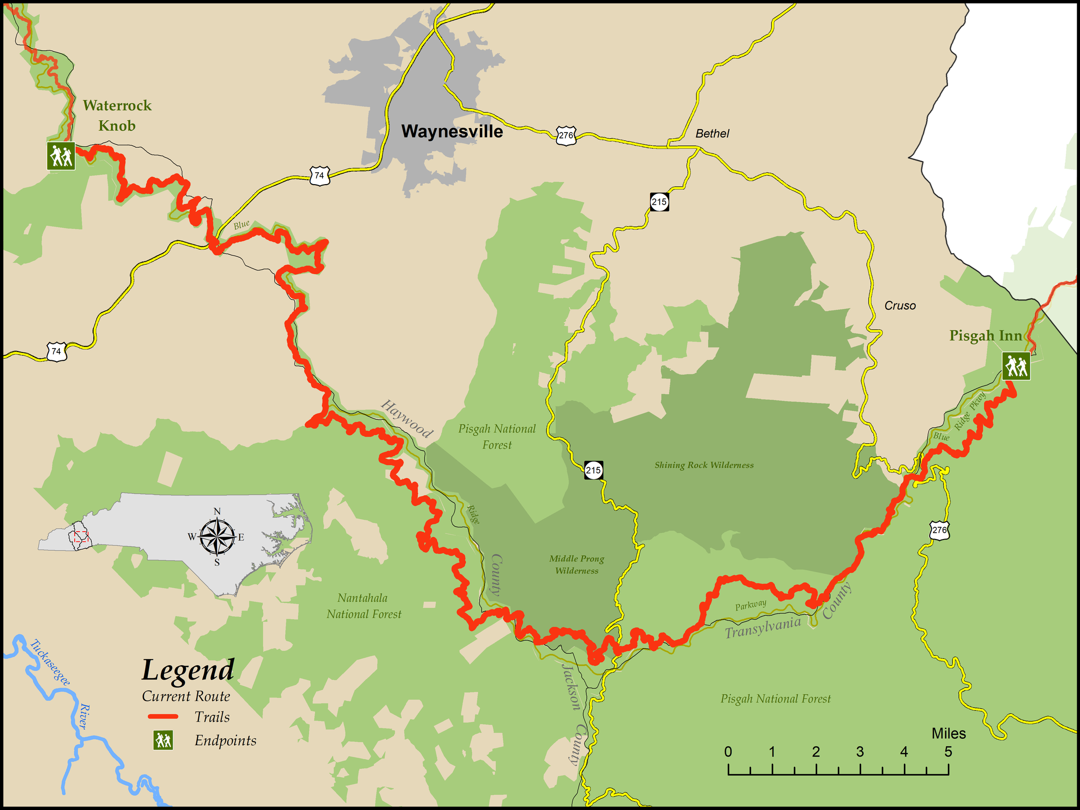
Waterrock Knob to Pisgah Inn
Distance: 63.6 miles (59.9 on trail, 1.9 on gravel roads, and 1.8 on paved roads)
Difficulty:

Significant elevation changes involving steep climbs and descents, difficult trail tread, and long stretches with no road crossingsCheck Trail Updates before starting your hike. To receive email notifications of new trail updates, click here and subscribe to “Trail Updates.”
If you find hazardous conditions or maintenance needs along the trail, please notify us using the form at mountainstoseatrail.org/the-trail/trail-issues.
By Jim Grode and Friends of the Mountains-to-Sea Trail
This 63-mile segment, located in one of the most biodiverse areas of the world, showcases that diversity. Nearly all the major plant communities of the southern Appalachians are represented, from spruce-fir forests typically found in Canada to rich cove forests, and from rhododendron thickets to heath balds—and even a little of the rare spray cliff community. Around every corner is a view greater than the one before it. And the myriad streams and waterfalls provide delightful coolness even on the hottest summer day.
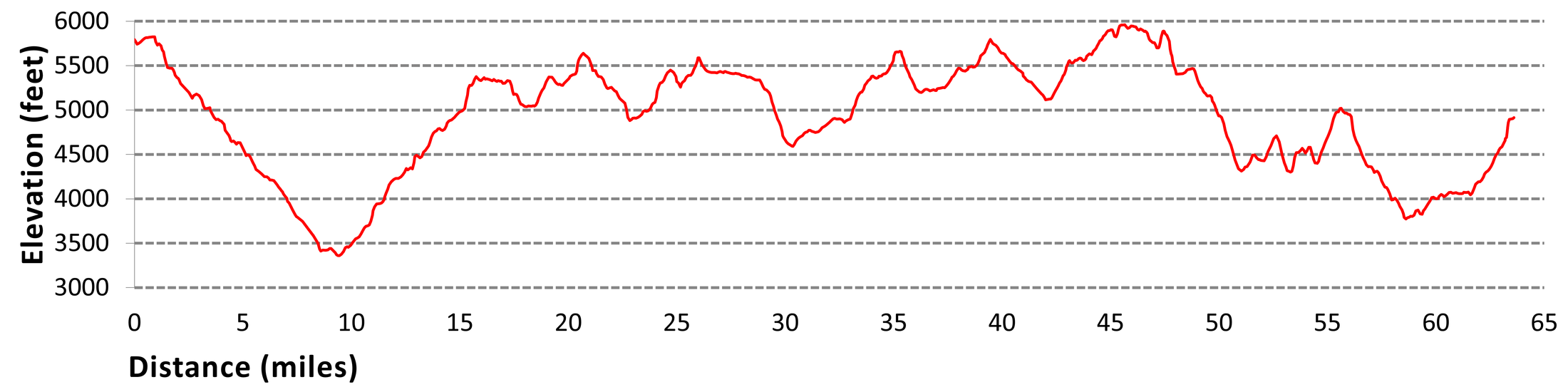
This segment is also one of the least accessible parts of the MST—although it generally parallels the Blue Ridge Parkway (BRP). Segment 2 crosses a paved road only 7 times in the 54 miles between the US 74 crossing (EB Mile 9.4; WB Mile 54.3) and its eastern end. The segment is also rugged: elevations range from over 5,800 feet to less than 3,500 feet in less than 10 miles, and there is almost 25,000 feet of climbing and descending over the entire length of the segment. The trail is often rocky, muddy, or indistinct, making travel sometimes difficult. Almost all of Segment 2 is on federally owned land, encompassing the Nantahala and Pisgah National Forests and the BRP. As a result, there is virtually no development and no opportunity for resupply on the segment.
Highlights Include
- The four-state views from Waterrock Knob, at 6,292 feet the highest point on Segment 2 and the third-highest point on the entire MST
- Skinny Dip Falls, a popular waterfall and swimming hole
- The nearly trackless expanse of the Middle Prong Wilderness Area
- The views over the ghost forest of Graveyard Fields
- The tourist haven of the Pisgah Inn, with its famous restaurant
Elevation
Segment 2 Eastbound Elevation Profile
Photos