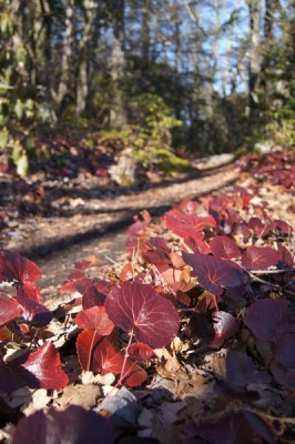
Day Hike 8: Cascades Recreation Area to Park Vista
Enchanted by the Escarpment
Distance: 4.1 miles
- Difficulty: Moderate. Generally downhill, with quick climbs along the way.
- Camping: No.
- Land manager: National Park Service.
- Volunteer Task Force Leader: Jim Hallsey, jhallsey@skybest.com.
- Piggyback trail: Cascades loop trail.
- Connecting trails: Cascades loop trail.
Throughout your hike on the Mountains-to-Sea Trail between Beacon Heights and Devils Garden Overlook, you’re generally aware of the Blue Ridge escarpment. Running from Virginia to Georgia, this 220 million-year-old geologic upheaval marks the delineation of the Southern Appalachians and the Piedmont. And a none-too-subtle delineation it is, with elevations changing as much as 4,000 feet in a relatively short distance from placid Piedmont to rugged high country.
But you’re most aware of the escarpment on this 4.1-mile stretch of MST, where the trail rarely leaves the lip of this impressive cliff. Here, it’s not unusual for the mountain to lose 1,300 feet of altitude in less than a half-mile. The drop is most notable, obviously, from the occasional clearings that provide sweeping views to the southeast. It’s perhaps most impressive, though, in dense forest, where the tops of mature hardwoods seem within reach from the trail. How these trees cling to impossibly steep slopes is testament to Mother Nature’s engineering skills.
At the end of the hike, the owners of the Park Vista Inn (MP 268) (unfortunately the restaurant is not currently open) allow hikers to park in their lot, but it’s essential to make arrangements in advance. (Call Anthony Smeltzer at 336-877-5200.)
View on Map
To see this hike on a map, visit our Interactive Map and click “Day Hikes” to view the endpoints.
Finding Your Way
| Finding Your Way (west » east) | Mileage |
|---|---|
| Trailhead: From the north end of the Cascades Recreation Area (MP 271.9), enter the woods following the signs to the cascades. After a few yards on the trail, take the left fork of this loop trail. The trail goes downhill and follows a stream. | 0.0 |
| After crossing a bridge, turn left going uphill to follow the MST. Cascade Falls is straight ahead. | 0.3 |
| Cross the BRP and go around the chain across a gravel road. Walk 40 feet to turn right to follow the MST. | 1.0 |
| Come out of the woods and walk down across a pasture. Walk north on the west shoulder of BRP past Phillips Gap Rd., which goes west. | 2.1 |
| Opposite a section of Phillips Gap Rd. that turns gravel and travels east (right), turn left into the woods. | 2.4 |
| Cross a pasture, going downhill. Keep near the tree line on the right, heading toward the BRP. | 2.7 |
| Cross the BRP diagonally. Look north for the MST sign at the end of the pasture where the woods begin. | 2.8 |
| Trailhead: Return to the BRP just south of intersection with Park Vista Rd. at Benge Gap (MP 268). The Park Vista Inn can be seen from BRP. | 4.1 |


