Day Hike 4: Trout Lake to Thunder Hill Overlook
A Proper Ramble
Distance: 7.0 miles, plus 0.3-mile connector trail
- Difficulty: Easy. All downhill on carriage trail.
- Camping: No.
- Land manager: National Park Service.
- Volunteer Task Force Leader: Randy Johnson, ranjohns@aol.com.
- Piggyback trail: Watkin Road, Cone Estate carriage trail
- Connecting trails: Black Bottom Road and Deer Park Road, Cone Estate carriage trails.
Imagine the plight of a wealthy industrialist looking for a little weekend R&R from the work-a-day world. What would you do if money wasn’t a concern?
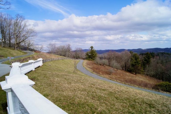
Something to think about as you head down the steps of Flat Top Manor at Moses H. Cone Memorial Park and hit the 25 miles of carriage trail that the wealthy industrialist in question, textile mogul Moses H. Cone, built as part of his 3,516-acre getaway from Greensboro. Cone and wife Bertha — with the help of many others, from the 30 tenant farmers who worked the grounds to Pennsylvania governor and noted conservationist Gifford Pinchot — fashioned this stunning turn-of-the-20th-century preserve that remains today, as part of the National Park Service, a lovely place for a walk.
Especially lovely for the recalcitrant rambler who wants to sample the MST. After a mile-and-a-quarter climb from Trout Lake up to Cone Manor, there’s 2.7 miles of gradual downhill on a foot-friendly, crushed gravel surface. At Black Bottom Road, another carriage trail, you have the option of continuing on the MST or taking Black Bottom for a return trip on carriage trail to the manor house on one of several carriage paths.
View on Map
To see this hike on a map, visit our Interactive Map and click “Day Hikes” to view the endpoints.
Finding Your Way
| Finding Your Way (west » east) | Mileage |
|---|---|
| Trailhead: From the back of the Trout Lake parking area, head out on the trail paralleling the lake shore. | 0.0 |
| At trail junction, turn right onto the MST. | 0.3 |
| Cross over a dam and continue to the right on a carriage trail along the lake. | 0.5 |
| Take the left fork going to the manor house. | 0.7 |
| Cross Flannery Fork Rd. to follow the trail toward the manor house. | 0.9 |
| At T-intersection, go right through tunnel under parkway. | 1.5 |
| The trail passes in front of carriage house, which has restrooms and water. Take unsigned trail to left before reaching manor house. | 1.7 |
| The carriage trail curves right. Continue straight, following signs to Watkin Rd. | 2.2 |
| Watkin Rd. intersects with Black Bottom Rd., which comes in from right. Follow signs to US 321. | 4.3 |
| Pass a lake on right. | 5.0 |
| Cross creek by rock hopping. Go right on gravel Old Camp Catawba Rd. You are walking through an area with some residential traffic. | 5.1 |
| Reach US 221/321. Turn left and walk 200 feet on shoulder of US 221/321. Turn left and walk up entrance ramp to BRP (MP 291.9). | 5.3 |
| Reach BRP and turn right (north). | 5.6 |
| Walk on shoulder of BRP to where trail goes into woods on right, just after crossing bridge over US 221/321. | 5.8 |
| Follow trail along hillside to stile, after which trail bears left and follows barbed-wire fence to pasture. | 5.9 |
| Continue through pasture and enter woods near fence along BRP. | 6.0 |
| Emerging from woods, trail cuts right across pasture to point below a pine tree on far side of pasture. Trail then travels along side of hill, down to two bridges. After the second bridge, trail goes through section of clearing. Continue into woods to another stile. | 6.4 |
| Hike uphill and into rhododendron thicket before reaching another stile at top of ridge. | 6.8 |
| In pasture, trail bears left along BRP through short section of woods and out to pasture. | 6.9 |
| Cross pasture to angled treeline that borders dirt farm road, leading into trees again. Bear left at fork and go into another pasture. | 7.0 |
| Out of woods, angle right (away from BRP) to stile at Greenhill Rd. next to farm gate. Climb over stile and go left (west) 200 feet to the BRP (MP 290.7), then turn right (north) and walk 500 feet. Cross the BRP and go through stile. Follow trail uphill through meadow, then go right. Go to top of hill and then head downhill toward overlook. | 7.1 |
| Trailhead: At bottom of hill, go through a stile and cross the BRP to reach Thunder Hill Overlook (MP 290.3). | 7.3 |


