Day Hike 2: Boone Fork Parking Area to Holloway Mountain Road Parking Area
Out to Pasture
Distance: 3.8 miles
- Difficulty: Easy. Gentle ascents through pastures.
- Camping: No.
- Land managers: National Park Service.
- Volunteer Task Force Leader: Randy Johnson, ranjohns@aol.com.
- Piggyback trail: Tanawha.
- Connecting trails: Tanawha.

Three meadows offer open relief on the trail between the Boone Fork Overlook and Holloway Mountain Road.
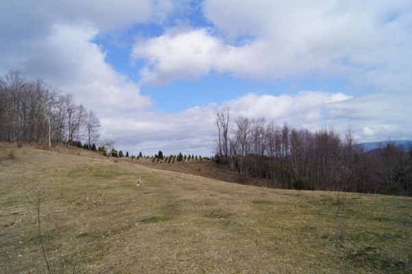
Wedged between the jumbled, rocky base of Grandfather Mountain (Day Hike 1) and the wet and wild Day Hike 3 is an oddly passive break, a pastoral oasis that rolls through three mountain meadows. On a sunny day under billowy white clouds you’re to be excused if, each time you emerge into one of these grassy breaks you go all von Trapp and belt out a rousing, “The hills are alive …”
Heading north, the MST goes through hardwoods & rhododendron. Just past the 0.2-mile spur trail to the Cold Prong access, you encounter your first meadow after squeezing through a tight stile. The trail isn’t always immediately obvious through these meadows. As a general rule, look for the MST’s white circle or the Tanawha Trail’s white feather symbol.
Hiked either direction, this is one of the easiest sections along the Blue Ridge Parkway.
View on Map
To see this hike on a map, visit our Interactive Map and click “Day Hikes” to view the endpoints.
Finding Your Way
| Finding Your Way (west » east) | Mileage |
|---|---|
| Trailhead: From Boone Fork parking area (MP 299.9), take spur trail 400 feet, then turn right on MST. | 0.0 |
| Cross bridge. | 1.4 |
| Cross another bridge. | 1.6 |
| Trail to Cold Prong Pond parking area (MP 299) is on right. Follow Tanawha Trail sign directing you toward Price Lake. You rock-hop 4 creeks in this segment. | 1.7 |
| Pass through stile to enter meadow. Go 50 yards and follow Tanawha Trail signs to make right turn. Walk 50 yards to enter woods, following MST sign. | 2.6 |
| Leave woods and enter field. Follow Tanawha Trail markers as trail veers left. | 2.8 |
| Go through wooded area to reach another meadow. Trail goes left (north) up the hill. On right, at bottom of hill, is graveled Holloway Mtn. Rd. As you approach woods at top of hill, you’ll see markers on the trees. | 3.0 |
| Trail goes in and out of wooded areas. Trail curves to left in field; gate at top of hill, but continue on trail. | 3.2 |
| Go through stile and enter meadow with good views of Grandfather Mtn. to right. At top of hill, there is tree-sheltered area. Signs for Tanawha Trail direct you to turn right here. You can follow that trail or head straight over the hill. | 3.3 |
| Trailhead: Descend downhill to Holloway Mtn. Rd. parking area. | 3.8 |


