Day Hike 7: Osborne Mountain Overlook to Cascades Recreation Area
Back in the Mountains
Distance: 6.0 miles
- Difficulty: Moderate. Steady climb.
- Camping: No.
- Land manager: National Park Service.
- Volunteer Task Force Leader: Jim Hallsey, jhallsey@skybest.com.
- Piggyback trail: No.
- Connecting trails: Short trail out of Cascades Recreation Area.
Not that there’s anything wrong with civilization (Day Hike 6), it’s just not what you seek on the trail. Beyond the Osborne Overlook the trail changes complexion, leaving humankind in the dust as it rises high above the parkway on a shelf trail through hardwood forest. This last mile and a quarter marks a warmup for the climbing that begins after the trail crosses U.S. 421.
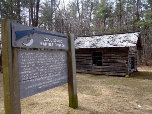
From U.S. 421 at Deep Gap, the trail begins a steady climb, gaining 670 feet in just over two miles. It’s even climbing through established forest. There’s a short breather before the trail climbs another 240 feet in three-quarters of a mile. From there it’s a mellow descent down to Tomkins Knob and the pasture that was once home to Cool Spring Baptist Church, an open-air place of worship that once hosted circuit-riding preachers.
Another three-quarter-mile of mellow descent, through a white pine forest, and you’re at the Cascades Overlook, home to picnic tables, great views, and a short hike to a scenic waterfall.
View on Map
To see this hike on a map, visit our Interactive Map and click “Day Hikes” to view the endpoints.
Finding Your Way
| Finding Your Way (west » east) | Mileage |
|---|---|
| Trailhead: From north end of Osborne Mtn. Overlook (MP 278), cross to west (left) side of BRP and go into grassy field and then uphill into woods. The next 1.25 miles follow switchbacks to the ramp at US 421 on the west side of the BRP. Parking space is available in flat grassy area on BRP 0.2 mile south of entrance ramp. Leave the woods on the west side of the BRP, just south of bridge crossing over US 421. | 0.0 |
| Cross bridge over US 421, walking left along the west shoulder of BRP, facing oncoming traffic. Cross BRP at “Roanoke” mileage sign. Trail goes uphill into woods on right side. | 1.3 |
| Trail goes steadily uphill for a gain of 650 feet in elevation, but trail through hardwoods high above BRP is well graded. | 1.6 |
| Cross BRP diagonally and enter woods on west (left) side. This level section comes back to BRP across from sign for E.B. Jeffress Park (MP 274.1). | 3.3 |
| Just north of sign for Jeffress Park, enter the woods on the east (right) side of BRP and begin short ascent. This section is an easy walk with moderate elevation changes. | 3.6 |
| Come out of the woods at Tomkins Knob parking area. Enter woods at north side of parking area, near the BRP. It is 75 yards to the Cool Springs Baptist Church and the Jesse Brown cabin historic area. | 5.2 |
| Go back into the woods at the north side of the historic area, just to the left of the sign about Cool Springs Baptist Church. The trail goes downhill slightly then becomes level. | 5.3 |
| Trailhead: Cascades Recreation Area (MP 271.9). | 6.0 |


