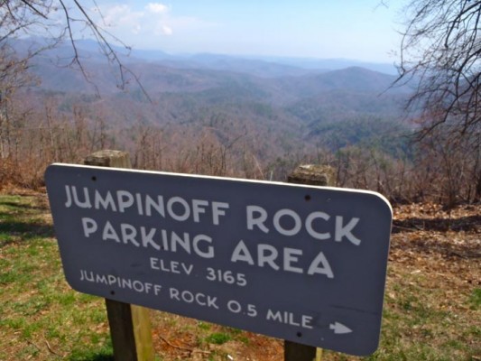
Day Hike 10: Jumpinoff Rock Overlook to Sheets Cemetery
Oh, Fudge!
Distance: 9.1 miles
- Difficulty: Moderate. Relatively flat stretch, long distance.
- Camping: No.
- Land manager: National Park Service.
- Volunteer Task Force Leader: Jim Hallsey, jhallsey@skybest.com.
- Piggyback trail: None.
- Connecting trails: None.
The meadows diminish somewhat on this stretch, which has a brush with civilization National Parks–style in the form of the Northwest Trading Post. Granted, you’re here to commune with nature. But what’s wrong with a pit stop for homemade fudge or to check out local crafts made by artsy types from northwestern North Carolina? Picnic tables outside for enjoying your lunch, a nice expanse of grass to stretch out and take in some rays on a sunny day. The lone drawback: the Trading Post is seasonal, open only May through October.
Back on the trail you’ll enjoy one of the flatter stretches of the MST along the BRP. Good thing, too, if you’re packing some extra Trading Post fudge.
View on Map
To see this hike on a map, visit our Interactive Map and click “Day Hikes” to view the endpoints.
Finding Your Way
| Finding Your Way (west » east) | Mileage |
|---|---|
| Trailhead: From Jumpinoff Rock Overlook parking area (MP 260.3), cross to west (left) side of BRP and enter woods to the north. Go 150 feet to gravel road. Turn right onto Doyle Bare Rd. Go 370 yards, pass gravel road on left (BRP is ahead). Before reaching parkway, just past the driveway, trail goes left into woods. Go on old logging road for 300 yards before turning right into woods. Come to and walk through field just below BRP. Go back into woods for 300 yards before coming back to BRP. Walk 220 yards on west (left) shoulder along split-rail fence. Come to Pony Farm Rd. (S.R. 1632). | 0.0 |
| Turn left on Pony Farm Rd., going away from BRP. Walk on gravel road that parallels BRP before going behind Northwest Trading Post to Trading Post Rd. | 1.8 |
| Pass New River Inn and Cabins, then cross Trading Post Rd. and walk 150 yards east (right) on the north side of the road. (Glendale Springs is 0.5 mile to the left.) Pass the Northwest Trading Post (MP 259) on the right. Sally Mae’s on the Parkway gift shop is inside, along with sodas, sandwiches, and fudge. Cross BRP and go left into woods just before Old Wilkes Rd. also goes off to the left. Walk about 950 yards before coming back to BRP. Turn right (north) and walk along east shoulder of BRP for 580 yards. Pass MP 258 on the way. Go back into woods on east (right) side. | 2.5 |
| When you come out of woods, gate to Sam Miller Cemetery is on right; BRP on left. Cherry Hill Rd. is straight ahead. Raccoon Holler Rd. and Raccoon Holler Campground are across BRP. Continue straight on Cherry Hill Rd. for 800 yards. MST goes into woods on left. | 4.0 |
| Trail comes out of woods at Cherry Hill Rd./Bare Creek Rd. intersection. BRP is on left; CH Coffeehouse Ln. is across the BRP. Bare Creek Rd. is on other side of Cherry Hill Rd. Walk on Bare Creek Rd. for 150 feet. MST goes into woods on left. Trail comes out of woods again at BRP and Bare Creek Rd. | 4.9 |
| Cross BRP to west side, staying on Bare Creek Rd. Go into woods north of Bare Creek Rd. Walk 660 yards back to BRP. Walk 125 yards north on BRP shoulder along fenceline. Go back into woods for 150 yards. Trail comes out at BRP (MP 256). | 5.5 |
| Cross BRP to Don Bare Rd. Entrance to Mountain View Lodge and Cabins is at this intersection. Walk 50 yards on Don Bare Rd., then turn left onto gravel Thistle Hill Ln. Walk 200 yards to left turn into woods. This is not well marked, so watch carefully for this turn. You can see a pond through trees on the right. Walk 150 yards to log steps leading down to small creek. Continue 0.4 mile to Roe Hunt Rd. (MP 255.3). | 6.1 |
| Cross to west side of BRP. Trail ascends gradually but steeply, then goes downhill for 0.8 mile to an interesting tree-root/rock area over a wet spot. | 7.2 |
| Still on west side, MST parallels BRP the whole way. It is 0.2 mile to switchback going downhill. It’s another 0.2 mile of path meandering in woods to arrival at junction of gated side road and BRP. | 8.1 |
| Cross gated road and continue on west side of BRP. There is a short switchback before trail travels parallel below the BRP for little over 0.2 mile before starting steep but gradual downhill for 0.3 mile to a switchback. It is 200 feet to BRP. | 8.5 |
| Trailhead: Walk north along BRP to gravel road leading to Sheets Cemetery. There are a few parking spots in front of gate, but do not block road. | 9.1 |


