Day Hike E: Bayleaf Church Road to Six Forks Road
Six Forks-Bayleaf Connector
Distance: 1.2 miles
- Difficulty: Easy.
- Camping: No.
- Land managers: N.C. Division of Parks and Recreation, N.C. Wildlife Resources Commission, U.S. Army Corps of Engineers. Note: Some or all of this trail is on game lands and hunting is allowed. Learn about local hunting seasons here.
- Volunteer Task Force Leader: Jeff Brewer, jdbrewer104@gmail.com.
- Piggyback trail: Falls Lake Trail, a/k/a South Shore Trail.
- Connecting trails: No.
- Falls Lake MST Section No.: 5.
- Trailhead/Access: Bayleaf Church Road and Six Forks Road. Click on map below for specifics.

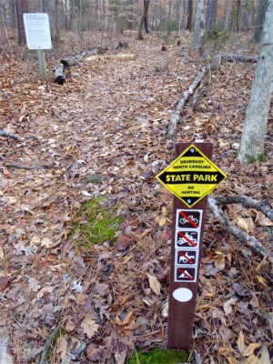
This short section is part N.C. State Parks land, part N.C. Wildlife Resources Commission game lands.
Up for a slightly longer hike than the 2.9-mile Day-Hike D? Tack on Day-Hike E and you’ve got a nice 4.2-mile hike (8.4 miles out-and-back). An especially attractive option if you worry about parking at a deserted trailhead: Six Forks Road has a fair amount of traffic and the parking north of the causeway is ample.
This stretch has several quick up-and-downs, making it more challenging than its 1.3 miles might suggest.
Geology Highlights: On this trail section there are excellent outcrops of light-colored, feldspar-rich gneiss. The rock contains thin layers that trend north-northeast and dip steeply toward the west. These rocks also show effects of a nearby fault.
For detailed hiking directions and parking information, download the Segment 10 guide from our Trail Guides page, using the “Primary Trailheads” section to pinpoint the location. You can also visualize the route on our interactive map.


