Day Hike Q: Hickory Hill Boat Ramp to Redwood/Tom Clark Roads
High Flying, Fast Driving
Distance: 2.3 miles
- Difficulty: Easy.
- Camping: No.
- Land managers: N.C. Wildlife Resources Commission, U.S. Army Corps of Engineers. Note: Some or all of this trail is on game lands and hunting is allowed. Learn about local hunting seasons here.
- Volunteer Task Force Leader: Jeff Brewer, jdbrewer104@gmail.com.
- Piggyback trail: No.
- Connecting trails: Occasional feeder trail to lake.
- Falls Lake MST Section Nos.: 19, 20
- Trailhead/Access: Hickory Hill Boat Ramp and the elbow of Redwood and Tom Clark Roads. Click on map below for specifics.
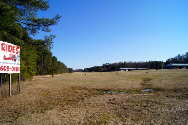
It would be easy to dismiss this short section as a connector between the more bucolic sections east and west of it. But this stretch has attributes in its own right, though perhaps not the kind you come to expect on a hiking trail. Take for instance Lake Ridge Airport. Stick around long enough and you may see a single-engine Cessna or Piper Cherokee glide down from above onto the runway.
Keep hiking and you’ll have another unusual trail opportunity: the chance to hike through a cement culvert under an interstate highway. (Note: The tunnel can be wet and muddy; watch your step.)
Thanks to the dense floodplain forest, it’s not long before you leave the roar of I-85 in your wake.
Geology Highlights: Large rounded (spheroidal) boulders of diabase are common along this stretch of the trail.
For detailed hiking directions and parking information, download the Segment 10 guide from our Trail Guides page, using the “Primary Trailheads” section to pinpoint the location. You can also visualize the route on our interactive map.


